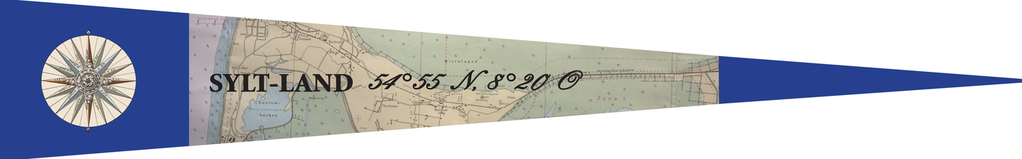
Sylt-Land pennant – nautical chart motif with coordinates 54°55 N, 8°20 E
Sylt-Land pennant – nautical chart motif with coordinates 54°55 N, 8°20 E
- Weltweiter Versand
- 14 Tage Widerrufsrecht
- 3-6 Werktage in Deutschland
Couldn't load pickup availability
Pennant "Sylt-Land with nautical chart" – Maritime design with regional reference
This special pennant depicts a historical nautical chart around the Hindenburgdamm causeway with the inscription "Sylt-Land" and the coordinates 54°55 N, 8°20 E. A decorative compass rose and the blue border emphasize the nautical character and make this motif a highlight for friends of maritime cartography and Sylt nostalgia.
Unique shape – made to withstand wind and weather
Thanks to its pointed, wind-permeable shape, this pennant is less susceptible to wind and therefore particularly durable. Ideal for boats, motorhomes, caravans, masts and gardens – anywhere a robust, long-lasting pennant is required.
Product details
• Shape: Pointed pennant, wind-resistant and durable
• Material: Robust, weatherproof polyester fabric of premium quality
• Printing: Visible on both sides (mirror printing) with clear, vibrant colors
• Attachment: Two sturdy rope loops made of high-quality flag rope